
Home/Projects

Checking reconstructed traces in a land 3D survey.

Anambra and Niger Delta basins, Nigeria

All projects & case studiesView the study figures
Project record

Challenge

Gaps in the recordings left some source–receiver offsets unevenly sampled. Before imaging, the team needed to see where interpolation added data and how it affected the amplitudes.

VerityGeo’s work

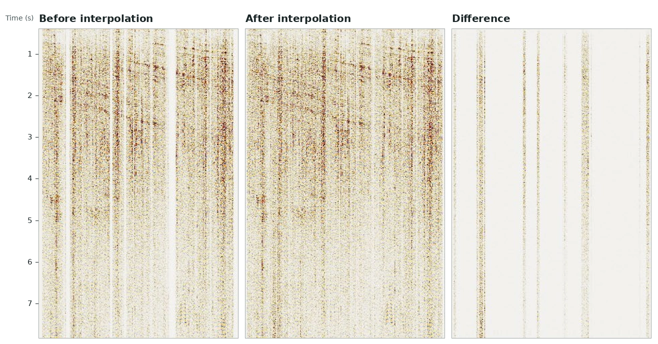
VerityGeo used anti-alias Fourier interpolation to estimate missing traces and moved traces to common bin centres. The team compared sections at the same offset and mapped root-mean-square amplitudes before and after regularisation.

Documented outcome

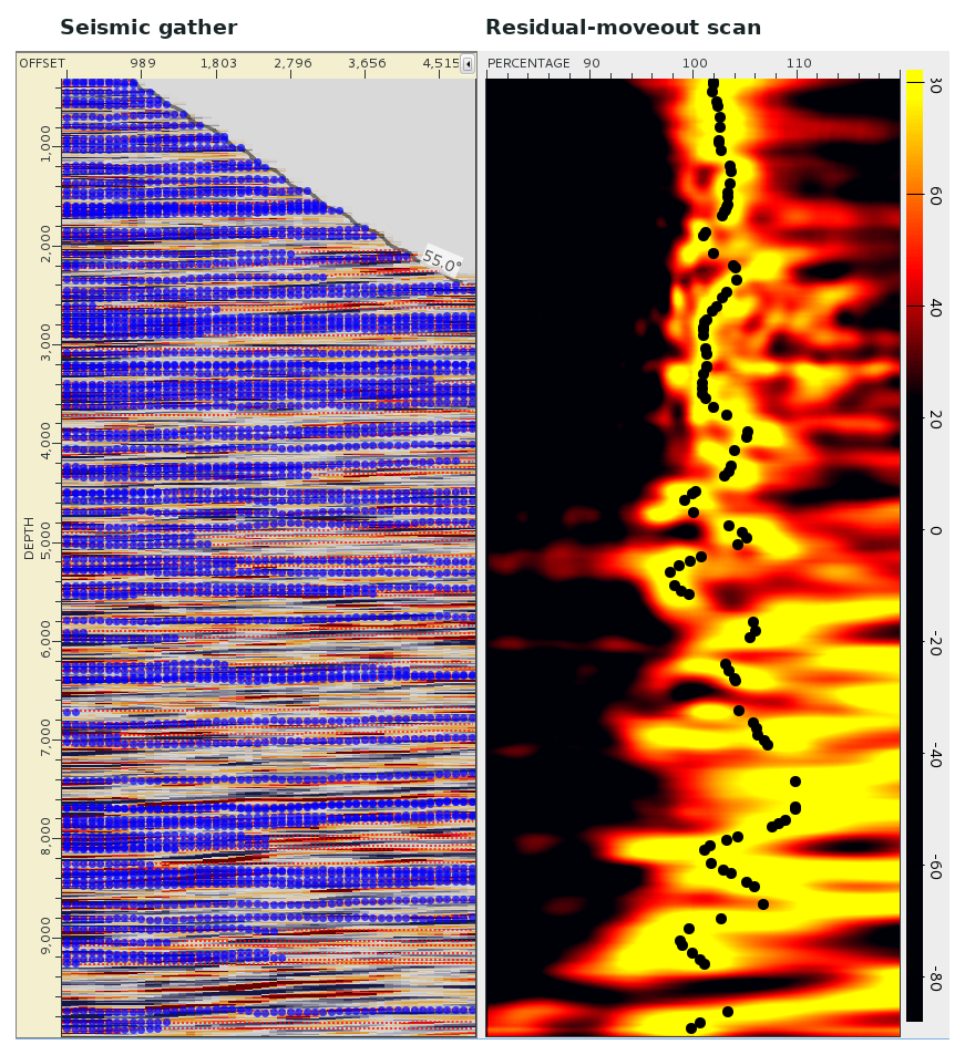
A difference section isolated the reconstructed traces for review. The team then measured residual moveout on migrated gathers to guide the next velocity-model update. The figures below show both checks.
Inside the reprocessing workflow

Three aligned sections showing original traces, interpolated output and vertical bands of added traces on a common time scale.
Offset regularisation

Where interpolation added traces

In this earlier land survey, the first two panels show the same offset range before and after interpolation. The difference panel isolates the estimated traces in gaps between recordings.

Open full size — Where interpolation added traces (opens in a new tab)
A seismic gather beside a colour residual-moveout scan with black picks along its strongest responses.
Velocity analysis

Picking residual moveout

In a previous land imaging study, the gather and percentage scan cover the same depth interval. The black picks follow the scan response used to assess residual moveout in the velocity model.

Open full size — Picking residual moveout (opens in a new tab)
Contact VerityGeo

Request a consultation