
Home/Projects

Planning 2D and 3D seismic coverage in a frontier basin.

Onshore frontier basin

All projects & case studiesView the study figures
Company-confirmed project

Challenge

Earlier surveys recorded weak reflections below shallow, high-impedance layers. The exploration team needed a design that would improve the chances of following reflectors and imaging faults at depth.

VerityGeo’s work

VerityGeo undertook survey design and acquisition planning for regional 2D lines and 3D coverage. The scope used signal-to-noise analysis of legacy data to estimate the fold needed at target, and included acoustic and elastic modelling, ray tracing, and acquisition-footprint analysis.

Design brief

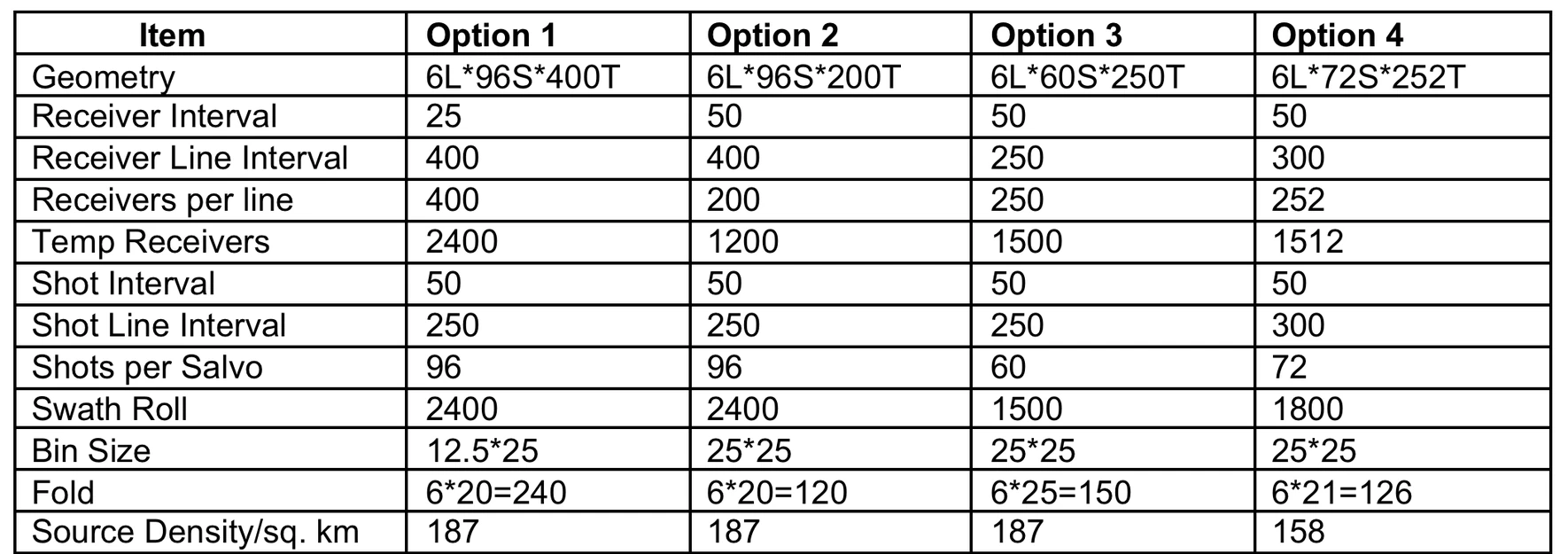
The brief specified a design report, acquisition parameter sheets and theoretical source and receiver positions in SPS format. Four candidate 3D layouts illustrate the choices in station spacing, recording patch size and nominal fold.
Survey planning figures

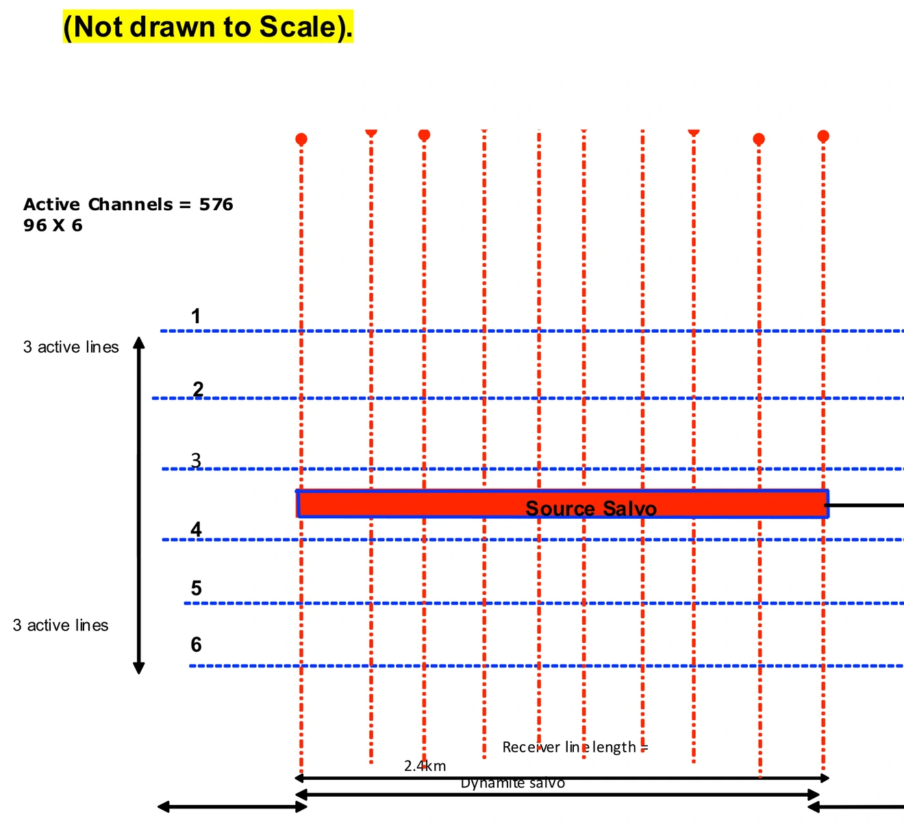
Plan view of six horizontal receiver lines with a highlighted source salvo at the centre.
Acquisition planning

Six-line recording template

The planning schematic places 96 receiver channels on each of six active lines. It shows the source salvo within a 576-channel recording patch.

Open full size — Six-line recording template (opens in a new tab)
Table of four candidate acquisition geometries, including receiver spacing, shot spacing, bin size and nominal fold.
Survey geometry

Four candidate survey layouts

The design table compares station and line spacing, bin size and nominal fold for four tentative 3D layouts. Nominal fold ranges from 120 to 240.

Open full size — Four candidate survey layouts (opens in a new tab)
Contact VerityGeo

Request a consultation